
Mapa topográfico Odenthal
Mapa interactivo
Haga clic en el mapa para ver la altitud.
Acerca de este mapa
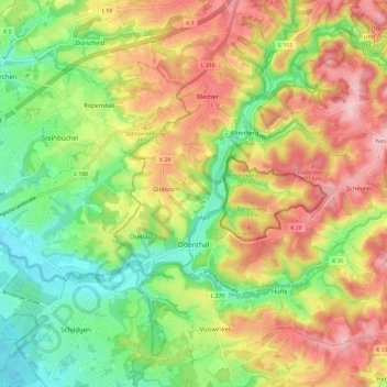
Nombre: Mapa topográfico Odenthal, altitud, relieve.
Altitud media: 143 m
Altitud mínima: 60 m
Altitud máxima: 237 m
Der Ort ist auf der Topographischen Aufnahme der Rheinlande von 1824, auf der Preußischen Uraufnahme von 1840 und ab der Preußischen Neuaufnahme von 1892 auf Messtischblättern regelmäßig als Odenthalverzeichnet.