
Mapa topográfico Lake Harris
Mapa interactivo
Haga clic en el mapa para ver la altitud.
Acerca de este mapa
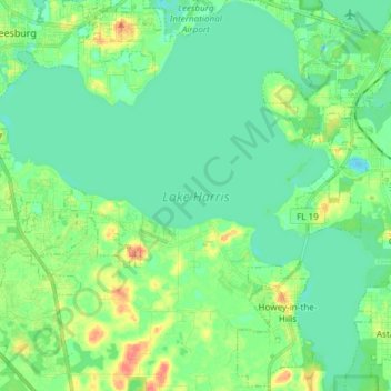
Nombre: Mapa topográfico Lake Harris, altitud, relieve.
Altitud media: 25 m
Altitud mínima: 11 m
Altitud máxima: 59 m
Lake Harris' depth is much greater than Lake Okeechobee to the south, with many deeper holes and ledges. The lake is surrounded by sandhills and cypress trees, part of the Central Florida Ridge. This region has the highest elevations in central Florida, reaching 312 feet (95 m) above sea level. Compared to the rest of Florida, which is relatively flat, it is quite hilly.