Mapa topográfico Denali
Mapa interactivo
Haga clic en el mapa para ver la altitud.
Acerca de este mapa
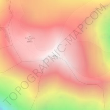
Nombre: Mapa topográfico Denali, altitud, relieve.
Lugar: Denali, Alaska, United States (63.06907 -151.00629 63.06917 -151.00619)
Altitud media: 5,546 m
Altitud mínima: 4,151 m
Altitud máxima: 6,170 m
Denali (/dəˈnɑːli/; also known as Mount McKinley, its former official name) is the highest mountain peak in North America, with a summit elevation of 20,310 feet (6,190 m) above sea level. With a topographic prominence of 20,194 feet (6,155 m) and a topographic isolation of 4,621.1 miles (7,436.9 km), Denali is the third most prominent and third most isolated peak on Earth, after Mount Everest and Aconcagua. Located in the Alaska Range in the interior of the U.S. state of Alaska, Denali is the centerpiece of Denali National Park and Preserve.
Otros mapas topográficos
Haga clic en un mapa para ver su topografía, su altitud y su relieve.
Denali National Park
United States > Alaska > Denali
Denali National Park, Denali, Alaska, United States
Altitud media: 833 m
Alaska Range
United States > Alaska > Denali
Alaska Range, Denali, Alaska, United States
Altitud media: 5,076 m
Mount Foraker
United States > Alaska > Denali
Mount Foraker, Denali, Alaska, United States
Altitud media: 4,650 m